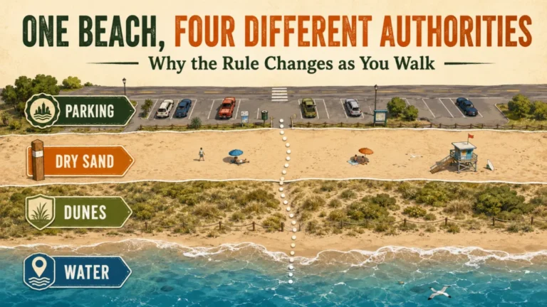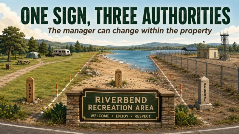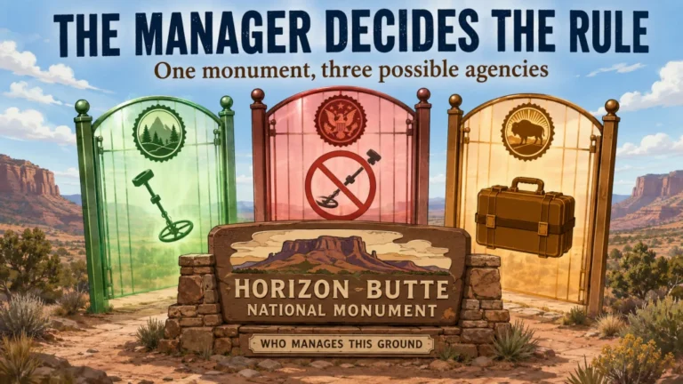
Metal detecting on the beach is legal only when the exact manager, parcel, approved zone, activity, and current conditions all permit it. A beach can be open to the public while detector possession, operation, probing, digging, dune entry, water entry, or object removal remains restricted. The wettest visible sand is not automatically a property boundary, and one shoreline can cross municipal, state, federal, tribal, port, military, or private control. Confirm the current policy and posted zone before the hunt, then stop if cultural resources, closures, unsafe water, severe weather, unstable scarps, or unexploded-ordnance warnings appear.
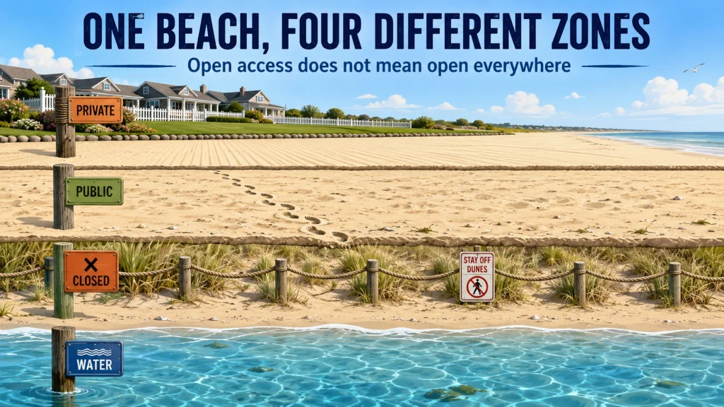
A Public Beach May Contain Several Different Permission Zones
Metal detecting on the beach does not begin with the sand. It begins with the access point, waterbody, parcel, and manager. A single shoreline can include a city swimming beach, private dry sand, a state-managed dune, a federal refuge, a port security area, and a separate water boundary within a short walk. Public access to one section does not carry across every internal line.
I approach beach research the same way I approached a complicated parcel during my surveying career: identify the ground first, then decide which rule controls it. The beach name on a tourism page is not enough. I want the official manager, a current map, the approved-use zone, the activity restrictions, and any seasonal or emergency order that changes normal access.
This article covers legal access, beach zones, boundary questions, timing, and safe conditions. It does not recommend beach detectors or explain settings, sweep technique, water hunting, or target recovery. The wider guide to finding legal metal detecting locations provides the broader land-research framework.
Identify the Exact Beach and Waterbody Type
The word beach describes a surface, not a legal category. Ocean beaches may involve tidal datums, public-trust rules, federal coastal units, private dry sand, and marine safety conditions. Great Lakes beaches have changing water levels and dangerous currents but do not use ocean-tide logic in the same way. Inland lakes, river beaches, and reservoirs may follow parcel boundaries, flowage easements, project rules, drawdown zones, or state and local ownership.
Privately maintained beaches add another layer. A hotel, homeowners association, campground, concessionaire, or private club may maintain the sand without owning the entire shore, or may control access without controlling the waterward boundary. The reverse can also happen: the public may have access to walk through an area while digging or removing objects remains prohibited.
| Beach type | First question to verify | Common source of error |
|---|---|---|
| Ocean coast | Who controls the dry sand, intertidal area, and access route? | Treating a current wet-sand mark as the legal line |
| Great Lakes | Which state, local, federal, tribal, or private manager controls the parcel? | Applying ocean tidal language to a non-tidal shoreline |
| Inland lake | Who owns or manages the beach and lakebed? | Assuming public boating access permits shore digging |
| Reservoir | Is the project managed by Reclamation, USACE, a utility, a state, or another owner? | Treating exposed drawdown ground as unregulated land |
| River beach | Who controls the bank, bed, island, and access path? | Assuming navigable water creates permission on the bank |
| Privately maintained beach | Does the operator control access, ownership, or both? | Confusing maintenance with legal authority over every zone |
The correct manager may change with water level, direction of travel, or an internal boundary. Record the exact access point and intended search strip before looking for a rule.
Beach Manager and Approved-Zone Decision Tree
Use this sequence before packing the detector. Each “no” answer stops the workflow until the missing information is resolved.
- Can you identify the exact beach, access point, parcel, and waterbody?
- No: obtain an official map or parcel description.
- Yes: continue to the manager check.
- Can you identify the current land manager for the exact search strip?
- No: contact the city, county, state, federal project office, tribal authority, port, or private operator responsible for the location.
- Yes: read the manager’s current detector and resource rules.
- Does the policy allow detector possession and operation?
- No: do not carry or operate the detector in that zone.
- Yes: check whether use is limited to a designated beach or previously disturbed area.
- Is the intended strip inside the approved zone today?
- No: stay outside dunes, habitat closures, restoration areas, security zones, and unapproved shoreline sections.
- Yes: verify the allowed recovery actions.
- Are probing, digging, scooping, water entry, and removal allowed?
- No or unclear: ask the manager before disturbing the surface.
- Yes: check permit conditions and found-property rules.
- Are there current closures or unsafe conditions?
- Yes: postpone or move to a verified open zone.
- No: carry the written policy or permit and keep watching posted signs.
This tree prevents the common mistake of asking only, “Can you metal detect on beaches?” The workable question is narrower: “May I perform these exact actions in this exact zone under today’s policy and conditions?”

Garmin eTrex 32x is a handheld GPS navigator with a 2.2-inch sunlight-readable color display. It comes with TopoActive maps and supports GPS and GLONASS satellite systems. It also includes 8 GB of internal memory, a microSD card slot, a 3-axis compass, and a barometric altimeter.
Check On AmazonIf you click this link and buy, we earn a commission at no additional cost to you.
Public Access Does Not Authorize Every Detecting Activity
A public walkway, parking pass, fishing license, swimming area, boat ramp, or day-use fee proves access for a stated purpose. It does not automatically authorize detector possession, operation, probing, digging, sand scooping, dune entry, water entry, or removal. Managers can regulate each action separately because each creates a different resource, safety, or ownership concern.
For example, a manager may allow an assembled detector only inside a marked swimming beach, require holes to be restored, prohibit vegetation disturbance, close the water after lifeguard hours, and require valuable found property to be surrendered. Another beach may permit walking and swimming but prohibit any ground disturbance. A third may allow lost-item recovery only after staff approval.
| Action | What must be confirmed |
|---|---|
| Detector possession | Whether the device may be carried assembled in the area |
| Detector operation | Where and when the machine may be switched on and used |
| Probing or digging | Allowed tools, depth, hole-restoration rules, and surface restrictions |
| Sand scooping | Whether scooping is treated as digging or disturbance |
| Dune entry | Whether access is limited to marked crossings or prohibited entirely |
| Water entry | Lifeguard, current, boating, closure, and jurisdiction rules |
| Object removal | Found-property, cultural-resource, natural-resource, and ownership rules |
Do not use permission for one action as proof of another. Ask the manager to address the complete workflow, especially when the policy page says only that “metal detecting” is allowed.

The Garrett Pro-Pointer AT is a handheld pinpointer with three adjustable sensitivity levels. Its fast retune function can narrow the detection field and help pinpoint a target more precisely. The unit uses single-button controls and is listed as waterproof for detecting around beaches, rivers, and other wet environments.
Check On AmazonIf you click this link and buy, we earn a commission at no additional cost to you.
Verify the Manager, Permit, Zone, and Found-Property Rule
The first detailed check belongs in the beach-access workflow: ownership, manager, permits, approved zones, digging restrictions, dunes, habitat closures, and found-property rules. The guide to verifying public beach detecting permission explains how to confirm those points without relying on crowd behavior or an old forum post.
Use the manager’s current policy page, permit page, posted map, local order, closure notice, and written response. Save the date and a copy of the document because seasonal rules and emergency closures can change after the general recreation page was published. A screenshot of a map is useful only if it shows the legend, issuing office, date, and enough surrounding detail to identify the zone.
When asking for clarification, name the exact access point and actions. “Is metal detecting allowed?” is too broad. Ask whether detector possession, operation, shallow probing, digging, scooping, water entry, and removal are allowed in the proposed strip, and whether a permit or reporting process applies.
One Wet-Sand Mark Is Not Automatically a Legal Boundary
A visible wet-sand line records recent water action. Wind, waves, storm surge, river flow, lake levels, beach slope, drainage, and the previous tide can move or blur that mark. It is not automatically the technical mean high water datum, the state public-trust boundary, the private-property line, or the edge of a manager’s approved zone.
The phrase “mean high tide line” is also used loosely in public conversation. Technical tidal datums are calculated from water-level observations over a defined period, while legal shoreline boundaries depend on state law, surveys, deeds, court decisions, federal rules, and site-specific facts. Great Lakes, inland lake, reservoir, and river boundaries may use different concepts entirely.
The guide to interpreting the mean high tide line for detecting explains the difference between a current wet mark, a measured datum, public access, and private dry sand. Until that boundary is verified, do not use the darker sand as permission to cross signs, fencing, dunes, private access controls, or agency lines.
Timing Changes Access, Exposure, and Safety
Beach metal detecting timing is not limited to finding a low tide. Tides and lake levels change how much ground is exposed, storms can erode one section while depositing sand on another, reservoir drawdowns can uncover restricted project land, and crowds can make an otherwise approved zone impractical. Conditions that reveal targets can also produce dangerous surf, unstable scarps, debris, contaminated water, or emergency closures.
Check official tide or water-level data, surf and weather forecasts, beach advisories, project notices, and local closure pages. Compare the expected low or drawdown with the access route and return path. A narrow strip available on arrival may disappear before the hunt ends, and a dry entry route may flood or become cut off.
The guide to choosing the best beach detecting time covers tides, water levels, storms, erosion, deposition, crowds, drawdowns, and safety in more detail. Timing improves a hunt only after the manager and zone are already confirmed.
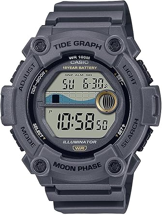
Casio WS1300H is a digital watch with a built-in tide graph. It also includes a countdown timer, 1/100-second stopwatch, LED backlight, and multiple alarms. The Amazon listing specifies 100-meter water resistance and a 10-year battery.
Check On AmazonIf you click this link and buy, we earn a commission at no additional cost to you.
Use Current Documents, Not a General Memory of the Rule
Beach rules can change by owner, parcel, zone, season, habitat order, storm damage, construction phase, water quality, and emergency response. A policy that was accurate last summer may not cover a new nesting closure, renourishment project, damaged access point, military exercise, or revised permit.
Before leaving, verify five items:
- The manager’s current policy or regulation.
- The permit page and any expiration or carrying requirement.
- The posted map showing the approved detecting zone.
- The latest closure, restoration, habitat, safety, or emergency notice.
- A written response when the online material does not answer the exact activity.
Carry the relevant document in a form that still works without cell service. A saved copy does not override a new posted closure, ranger instruction, tribal restriction, or emergency order, so read the signs again when you arrive.

Sea to Summit TPU Guide Map Case is designed to protect maps and documents from water and dirt. It uses welded construction with a ZipLoc top closure and includes a detachable neck strap. The PVC-free TPU material is flexible and resistant to UV exposure and extreme cold.
Check On AmazonIf you click this link and buy, we earn a commission at no additional cost to you.
NPS-Administered Beaches Remain Subject to NPS Restrictions
A beach inside a unit administered by the National Park Service is not treated like an ordinary city beach merely because the public may swim, fish, camp, or drive there. Under 36 CFR 2.1, possessing or using a mineral or metal detector and similar equipment is generally prohibited in park areas, subject to narrow stored-transport and authorized-use exceptions.
That restriction applies to NPS-administered beaches, including national seashore land and water within the park boundary. Do not assume that staying below a wet-sand mark, avoiding excavation, or searching only for modern coins creates an exception. Check the current park regulations and superintendent’s compendium before transporting equipment through the unit.
Warning: A recreational beach can be open while detector possession remains prohibited. The allowed public activity and the detector rule are separate questions.
National seashore boundaries can also adjoin state, local, private, refuge, or other federal land. Confirm the precise manager before applying the NPS rule outside the NPS parcel, but never treat an internal boundary as obvious without an official map.
USACE Projects May Limit Use to Designated or Disturbed Areas
At water-resource projects administered by the U.S. Army Corps of Engineers, 36 CFR 327.14 allows metal-detector use on designated beaches or other previously disturbed areas unless the District Commander prohibits it to protect archaeological, historical, or paleontological resources. The regulation directs visitors to the manager’s office for project-specific policy and designated-use information.
This does not mean every sandy shoreline around a Corps lake is approved. One project may name specific swimming beaches, another may recognize certain disturbed areas, and another may close all practical locations because no designated beach exists or sensitive resources are present. Water drawdown does not convert an unapproved lakebed into a detecting zone.
Found objects must also be handled under project rules. A detectorist should verify whether property must be reported or surrendered, whether digging tools are restricted, and whether the project has a value threshold or separate lost-property process. The project office, not a general national summary, provides the operational answer for that lake.
Check Overlapping Resource, Security, and Closure Rules
An otherwise accessible beach can be restricted because of shipwrecks, archaeological sites, military property, tribal authority, ports, wildlife habitat, restoration work, or an emergency order. These controls may apply to only one section or season, which is why a broad “beach open” notice is not enough.
- Shipwreck and archaeological areas: Do not search, disturb, or remove material associated with a wreck, structure, occupation site, or artifact concentration.
- Military and former defense areas: Obey restricted-access and unexploded-ordnance warnings. Do not touch suspicious metal objects.
- Tribal land and water: Public maps, roads, or shoreline access do not establish detecting permission from the proper tribal authority.
- Ports and security zones: Access rules can change around terminals, navigation facilities, secured waterfronts, and active operations.
- Dunes and habitat closures: Roped or signed areas may be closed to all entry, not merely vehicles or pets.
- Restoration and renourishment: Construction zones, planted dunes, equipment corridors, and newly placed sand may have temporary restrictions.
- Emergency closures: Storm damage, contamination, wildfire, rescue operations, debris, and infrastructure failure can override routine access.
If two authorities appear to overlap, comply with the more restrictive current instruction until the responsible offices clarify the boundary and activity.
Use a Cultural-Resource Stop Rule
Stop detecting when the setting changes from scattered modern loss to archaeological context. Ship timbers, ballast, structural remains, foundations, concentrated ceramics, military features, human remains, burial objects, or a dense artifact scatter are not signals to widen the search. They are reasons to stop disturbing the area.
Leave the object and surrounding material in place. Do not clean it, move nearby objects, enlarge the hole, or publish coordinates. Record enough general information to report the observation through the manager’s current procedure, but protect the location from public exposure.
Key point: A modern beach can cover an older cultural landscape. Sand movement may expose context that was not visible during the previous visit.
If human remains, ordnance, hazardous debris, or an immediate public-safety issue may be present, back away and contact the appropriate manager or emergency channel. Do not attempt to identify or recover the item yourself.
Legal Access Does Not Make the Conditions Safe
Beach safety must be checked separately from permission. Ocean and Great Lakes currents can pull people away from shore, waves can knock down an operator carrying equipment, lightning can arrive while surf noise masks thunder, and a steep erosion scarp can collapse without warning. River flow and reservoir release conditions create different hazards.
Review the official forecast, tide or water-level prediction, beach hazard statement, lifeguard status, and water-quality advisory. Stay out of closed water, avoid working beneath unstable scarps, and keep away from jetties, piers, inlets, spillways, outlet currents, and active construction unless the manager has identified a safe public area.
Contaminated water and harmful algal blooms can make wading or handling wet sediment unsafe. Wildlife closures protect both visitors and nesting animals. An unexploded-ordnance sign, suspicious cylinder, projectile, fuze-like object, or military debris is an immediate stop condition, not a target-recovery challenge.
A productive-looking cut is never worth entering a closed or dangerous zone. Recheck conditions during the hunt because tides, waves, lightning, releases, and emergency orders can change faster than the original plan.
Scott’s Evidence Blueprint: Separate Boundaries from Beach Shape
My surveying background gives me a method for boundary research, not authority to declare a shoreline line in the field. I begin with the official manager and parcel records, identify the datum or boundary concept being used, compare the map with fixed reference features, and note where access rights and activity rules differ. When a legal boundary remains uncertain, I stop at the uncertainty and ask the responsible office.
Beach-profile observations serve a different purpose. I document the date, tide or water level, recent weather, slope, scarps, exposed hardpan, deposition, access route, and closure signs so I can compare physical conditions between visits. Those observations can explain why more or less ground is exposed, but they do not move a deed line, establish public trust, or override a posted zone.
- Identify the exact beach and manager from official records.
- Save the dated policy, permit, map, and closure notice.
- Mark fixed access features and approved-zone limits.
- Record the tide, lake level, drawdown, storm, and beach profile separately.
- Do not convert a wet mark or erosion cut into a legal conclusion.
- Ask the manager when the map and physical shoreline do not align clearly.
This method keeps two questions separate: where the sand moved and where the authority allows the activity. Confusing them is how a promising beach turns into a boundary problem.

This pocket notebook uses weatherproof paper designed for outdoor fieldwork. Each notebook has 100 pages with a top-spiral format and an impact-resistant Wire-O binding. The Polydura cover helps protect field notes from scratches and stains during use.
Check On AmazonIf you click this link and buy, we earn a commission at no additional cost to you.
Final Thoughts: Confirm the Manager, Zone, Activity, and Conditions
A beach is not legal detecting ground merely because people can walk or swim there. Identify the exact parcel and manager, confirm detector possession and use, locate the approved zone, verify digging and removal rules, and check current closures before arriving. Treat the visible wet-sand mark as a field observation until the applicable boundary has been established through the correct legal and technical sources.
Once permission is clear, review tides, water levels, weather, surf, water quality, wildlife closures, and access conditions again. Stop at cultural resources, suspicious military material, unstable terrain, or any posted restriction. A good beach hunt starts with ground that is both authorized and safe.
Explore More Beach Access Guides
These guides take the three decisions in this article further: who controls the beach, where a shoreline boundary may fall, and when conditions make an approved zone practical to hunt.
| Guide | What it helps with |
|---|---|
| Public Beach Access and Permission | Verify ownership, permits, approved zones, digging limits, dunes, closures, and found-property rules. |
| Mean High Tide Line and Beach Boundaries | Separate technical tidal datums, public-trust concepts, private dry sand, and visible wet-sand marks. |
| Best Time and Conditions for Beach Detecting | Assess tides, lake levels, storms, erosion, deposition, crowds, drawdowns, and safety. |
Use the guide that matches the unresolved part of the plan before treating the beach as ready to hunt.
FAQs
🏖️ Can you metal detect on public beaches?
Sometimes, but public access alone is not permission. Confirm the exact manager, approved zone, detector rule, digging restrictions, removal policy, and current closures.
🌊 Is wet sand always public detecting ground?
No. A visible wet-sand mark is not automatically the legal property line, mean high water datum, public-trust boundary, or approved detecting-zone edge.
🗺️ How do I find who manages a beach?
Start with the official beach or project page, then check parcel maps, agency maps, posted signs, permit pages, and the responsible office. Identify the exact search strip, not only the beach name.
🏞️ Can I use a detector on a National Park Service beach?
NPS rules generally prohibit possessing or using metal detectors in park areas, subject to narrow exceptions. Check the current park rule before transporting equipment through the unit.
💧 Are exposed reservoir beaches open to metal detecting?
Not automatically. Drawdown exposes managed land or lakebed, and the project may limit use to designated beaches, previously disturbed areas, or permit-approved zones.
🐦 Can I enter a closed dune if the tide reaches the fence?
No. Habitat and dune closures can prohibit all entry regardless of tide height or the amount of open sand. Follow the signs and use marked access routes.
⛈️ Should I hunt immediately after a beach storm?
Only after checking closures, surf, lightning, water quality, access damage, debris, and unstable scarps. Erosion can expose ground while making the location unsafe or temporarily closed.
⚓ What should I do if I find possible shipwreck material?
Stop, leave the item and context undisturbed, avoid publishing the location, and follow the manager’s reporting procedure. Do not continue searching the surrounding concentration.
Sources and References
- Electronic Code of Federal Regulations, 36 CFR 2.1: current National Park Service rule covering protected resources and possession or use of metal detecting devices.
- National Park Service, Assateague Island Laws and Policies: current national seashore guidance confirming that metal detector possession and use are prohibited on NPS-managed lands.
- Electronic Code of Federal Regulations, 36 CFR 327.14: USACE rule allowing detector use on designated beaches or other previously disturbed areas unless restricted for resource protection.
- NOAA Tides and Currents: official tide predictions, observed water levels, station datums, and coastal conditions.
- NOAA VDatum, Tidal Datum Tutorial: definitions of mean high water and other technical tidal datums used in shoreline measurement.
- National Weather Service, Beach Safety: official guidance on tides, waves, currents, lightning, forecasts, advisories, and changing beach hazards.
- National Weather Service, Great Lakes Beach Hazards: forecasts and safety information for Great Lakes waves and dangerous currents.
- U.S. Environmental Protection Agency, Find Information About a Particular U.S. Beach: beach advisory, closure, and water-quality information through the BEACON system.
- U.S. Fish and Wildlife Service, Parker River Beach Closures: official example of seasonal shorebird, dune, and public-entry restrictions.