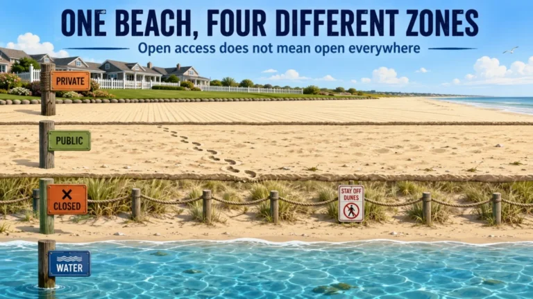
Public access to a beach tells you where you may enter, not whether you may use a detector, dig, wade, or keep what you find. The safe way to verify a hunt is to identify the actual manager, locate the controlling rule, and confirm the exact approved zone before you arrive. I treat the beach name as a starting clue, not as proof of authority, because one shoreline can cross city, county, state, federal, tribal, and private management in a surprisingly short distance. By the end of this guide, you will have a repeatable process for checking permission, tools, water entry, reporting duties, and temporary closures without relying on hearsay.
Public Access Does Not Approve Every Beach Activity
The first mistake is treating the word public as a complete answer. A public access point may authorize walking, swimming, or reaching the shoreline while separate rules control metal detector use, probing, digging, sand scoops, entry into the water, and removal of found property. Those activities can also be governed by different authorities on the same beach.
That distinction matters because a parking sign or tourism page usually describes visitor access, not the full operating rule for a detectorist. A beach can be open from sunrise to sunset and still limit digging to dry sand, prohibit disturbance in dunes, require a permit, or allow detector use only for recovery of a reported lost item. The practical question is not only, “Can I enter?” It is, “Which activities are approved in the exact place where I plan to search?”
This is the legal groundwork that should come before the broader choices involved in planning a complete beach detecting trip. A detector setting can be changed in seconds. A hunt that begins in the wrong jurisdiction is harder to fix.

The Nokta Premium Digger is a metal detecting hand tool with a 7.5-inch stainless steel blade. The Amazon listing gives an overall length of 12.8 inches and a weight of 14.08 ounces. It also includes a belt holster for carrying the digger between recovery spots.
Check On AmazonIf you click this link and buy, we earn a commission at no additional cost to you.
Identify Ownership and Management as Two Separate Questions
A beach may be publicly owned, privately owned with a public access agreement, or divided among several parcels. Ownership tells you who holds the land interest. Management tells you which office writes, posts, interprets, or enforces the rule that affects your hunt. Sometimes they are the same entity, but not always.
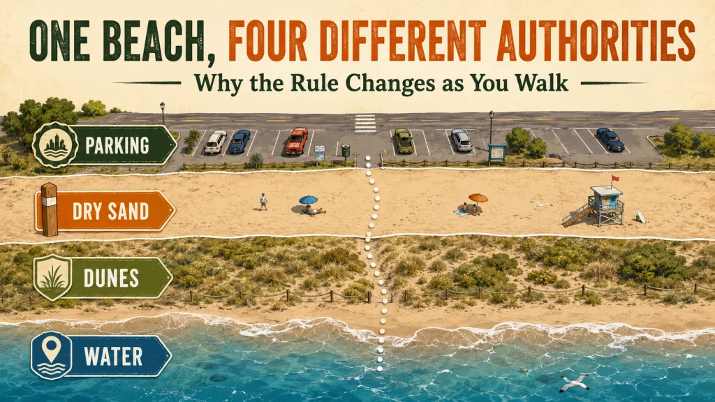
My surveying background taught me not to trust a familiar place name as a boundary. A beach name is useful for navigation, but it is not a legal description. The city may maintain the parking lot, a county may control the access corridor, a state agency may manage the dune system, and a federal project office may control the reservoir shoreline beyond the sand.
Start with official signs at the access point, then compare them with agency maps, park pages, project pages, and parcel information. The manager could be a city, county, state agency, U.S. Army Corps of Engineers (USACE) project office, National Park Service (NPS) unit, Fish and Wildlife Service office, tribal authority, port authority, water district, private association, resort, or a combination of those organizations.
Field Note: I write down the exact access point before I search for a rule. “North parking lot at the end of Bay Street” is much easier for an agency employee to verify than a general question about a beach that may extend for miles.
Confirm the Exact Approved Zone, Not the General Beach Name
Once the manager is known, divide the beach into activity zones. The same rule may not cover the water, wet sand, dry sand, dunes, vegetation, access corridor, parking area, historic feature, concession area, and adjacent parcel. A statement that detecting is allowed “on the beach” is still incomplete until the agency identifies what it means by beach.
| Zone | What to verify | Why it changes the answer |
|---|---|---|
| Dry sand | Detector use, digging method, hole filling, operating hours | This is often the most disturbed area, but it can still have tool or time limits. |
| Wet sand and shoreline | Jurisdiction, disturbance rules, protected resources, tide-related closure signs | The manager or legal boundary may differ from the upper beach. |
| Water | Wading, swimming-zone restrictions, detector use, recovery tools | Permission to search sand does not automatically authorize entry into the water. |
| Dunes and vegetation | Entry restrictions, nesting protection, restoration boundaries | These areas are commonly protected even when the nearby recreational beach is open. |
| Access and parking areas | Hours, fees, gate closures, separate municipal control | The route to an approved zone can close before the beach itself does. |
| Historic or concession areas | Special closures, lease boundaries, separate operator rules | A public recreation area can contain smaller excluded parcels. |
Ask for a map, named landmarks, numbered access points, or a written description whenever the boundary is not obvious. “South of the fishing pier on maintained sand” is usable. “Near the public beach” is not.
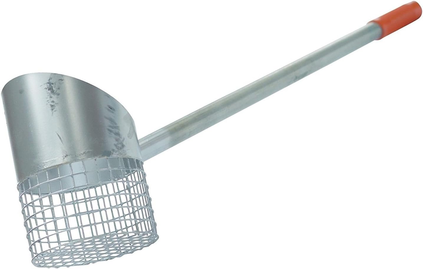
The RTG Privateer is a lightweight sand scoop made for beach metal detecting. It has a 24-inch handle with a soft rubber hand grip. Amazon lists the item weight at 1.9 pounds, giving it a straightforward long-handle format for beach target recovery.
Check On AmazonIf you click this link and buy, we earn a commission at no additional cost to you.
Find the Controlling Rule and Classify What It Allows
Public beach metal detecting rules can appear in a municipal ordinance, administrative rule, park policy, superintendent’s compendium, federal project rule, permit condition, posted restriction, or written agency response. Search the official manager’s site first. A forum post can alert you to a possible issue, but it cannot replace the current rule or the office responsible for the property.
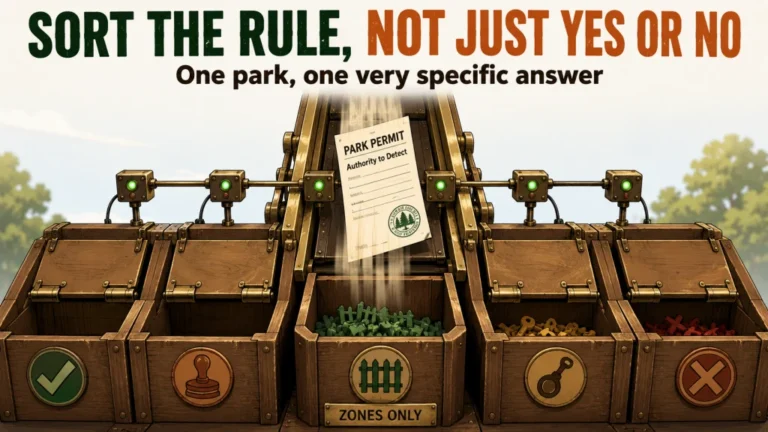
After locating the rule, classify it instead of reducing it to a vague yes or no. The category determines what you can actually do in the field.
| Rule category | What it means in practice |
|---|---|
| Allowed | Detector use is approved within the stated area and conditions. |
| Designated zones only | You must obtain the actual map or boundary before hunting. |
| Permit required | A beach detecting permit must be issued before the activity begins. |
| Restricted tools or disturbance | Detecting may be allowed while digging, probing, or certain scoops are limited. |
| Limited hours or seasons | The same location may change status because of operations, crowds, wildlife, or restoration work. |
| Lost-item recovery only | General recreational searching is not approved, but a supervised or documented recovery may be considered. |
| Prohibited | Do not detect unless the authority provides a specific written exception. |
A permit can also carry narrower conditions than the general policy, so read the permit itself. Do not assume that paying a fee grants access to water, dunes, or every tool you brought.
USACE and NPS Beaches Require Different Verification
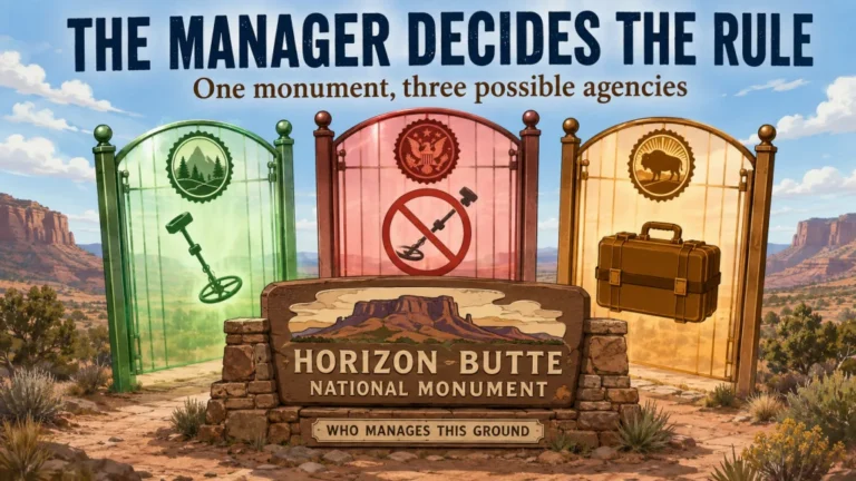
Federal management is where copying a rule from another beach becomes especially risky. The agency name, project boundary, local designation, and resource-protection rule all matter. Confirm current requirements with the managing office before every hunt because closures, approved zones, and permit conditions can change.
For U.S. Army Corps of Engineers water-resource projects, 36 CFR 327.14(d) states that metal detector use is permitted on designated beaches or other previously disturbed areas unless the District Commander prohibits it to protect archaeological, historical, or paleontological resources. The same section directs the public to the manager’s office for the specific policy and designated use areas. That means the federal text is not a blanket approval for every shoreline around a Corps lake.
At a USACE project, ask the project office to identify the exact approved area and the local handling rule for finds. The current federal text also distinguishes certain non-identifiable low-value coins from items that must be handled under the project’s lost-property provisions. Do not transfer a rule, value threshold, map, or enforcement practice from one project to another without confirmation.
National Park Service beaches remain subject to 36 CFR 2.1, which protects natural, cultural, and archaeological resources from possession, removal, digging, and disturbance. Park-specific closures and permit requirements may also appear in the superintendent’s compendium. Public entry into an NPS shoreline should never be treated as beach metal detecting permission unless the park provides clear current authorization for the proposed activity.
Warning: This article provides a verification method, not legal advice. Confirm the current rule, approved zone, and conditions directly with the agency that manages the exact beach you plan to visit.
Check Small Exclusions and Temporary Closures
A beach can be generally open while a smaller area is closed. Dunes, archaeological areas, nesting zones, restoration plots, military property, shipwreck protection areas, vegetation, and construction zones often have boundaries that do not match the recreational beach line. Temporary signs at the entrance may be newer than a webpage saved months earlier.
Look for date-specific restrictions before each trip, especially during nesting seasons, storms, restoration work, special events, or maintenance. A rule saved last year can still be useful background, but it is not proof that the same zone is open today. The date of the page or response belongs in your records for that reason.
Freshwater and reservoir beaches need the same caution. The surrounding municipality may promote the beach, while a project manager, water district, state agency, or federal office controls the shoreline and water. The office that collects the parking fee is not automatically the office that authorizes detector use.
Verify What You May Remove and What You Must Report
Permission to detect does not automatically settle ownership of a find. Before hunting, check the manager’s instructions for identifiable property, historic material, unclaimed property, and items found in federally managed areas. Rings with inscriptions, keys, phones, wallets, military items, and objects with identifying marks can trigger reporting duties even when ordinary modern coins may be treated differently.
Ask where a report should be made, what information the office needs, and whether the item must be surrendered. Also ask how long the agency retains unclaimed property and whether any return process exists. State unclaimed-property law or local ordinance may apply outside federal projects, so the answer can change across jurisdictions.
Key point: Separate four permissions in your notes: enter, detect, recover, and keep. A rule can approve the first two while limiting the last two.
If a target appears historic, archaeological, or connected to a protected site, stop disturbing it and contact the managing authority. The correct next move is documentation and reporting, not testing how much more of the object can be exposed.

The CKG Metal Detecting Finds Bag is designed to carry detecting tools and recovered finds. The listing gives dimensions of 8.2 x 3.9 x 11.8 inches and includes storage for a pinpointer. It also has drain holes for water and multiple mounting options for use with straps or detecting belts.
Check On AmazonIf you click this link and buy, we earn a commission at no additional cost to you.
Send a Written Inquiry That Can Produce a Usable Answer
Broad questions produce broad answers. “Can I metal detect there?” may be answered with a yes that only applies to one maintained section, or a no from an employee who thinks you mean dunes or archaeological searching. Give the office enough detail to evaluate the real activity.
Your inquiry should include:
- The exact beach, access point, and planned date.
- Recreational detector use, not commercial work or archaeological investigation.
- Whether you plan to probe, dig, or use a hand scoop.
- Whether you intend to enter the water and the approximate area.
- The specific dry-sand, wet-sand, shoreline, or water zone you want confirmed.
- Whether a permit is required and where it is issued.
- Any limits on tools, hole size, operating hours, seasons, or group activity.
- Find-reporting, identifiable-property, and historic-material procedures.
- Current temporary closures or protected areas near that access point.
A useful closing question is, “Could you identify the approved area on a map or by named landmarks?” That turns a general policy statement into something you can follow on the ground. Keep the answer exactly as received rather than rewriting it into a broader permission than the agency gave.
Build a Small Verification Record for Each Beach
I keep the rule date, manager name, written response, permit, and approved map together. The purpose is not to argue with an employee or officer. It is to make sure I can follow the same boundaries that the managing office described and notice when the information has become stale.
For a shoreline with several managers, build the record by segment. A practical blueprint might list the city access corridor, county-maintained dry sand, state-protected dunes, and federally managed water as separate rows. Do not fill in an outcome you have not confirmed. Leave the status marked “unknown” until the responsible office answers.
| Shoreline segment | Manager | Rule status | Evidence saved |
|---|---|---|---|
| Access and parking | Confirm from signs and official page | Open hours and access conditions | Current sign photo and webpage date |
| Maintained sand | Confirm municipal or park manager | Detector, digging, and tool category | Rule text or written response |
| Dunes or vegetation | Confirm resource manager | Closed, seasonal, or restricted | Boundary map and closure notice |
| Water or reservoir edge | Confirm project or water manager | Wading and recovery conditions | Project map, permit, or email |
Recheck the record when the date changes, a new sign appears, the access point moves, or your activity changes. Approval for dry-sand detecting with a probe does not automatically carry over to wading with a scoop.

This pocket notebook uses weatherproof paper designed for outdoor fieldwork. Each notebook has 100 pages with a top-spiral format and an impact-resistant Wire-O binding. The Polydura cover helps protect field notes from scratches and stains during use.
Check On AmazonIf you click this link and buy, we earn a commission at no additional cost to you.
Final Thoughts: Verify the Manager Before You Unload the Detector
The word public is not the permission slip. The manager, the controlling rule, and the approved zone are what determine whether your planned activity is allowed. Start with the exact access point, separate every shoreline zone, classify the rule, and get unclear boundaries confirmed in writing.
I would rather spend ten focused minutes checking the correct office than lose an afternoon following a rule copied from a different beach. Save the date, map, response, permit, and reporting instructions, then follow the narrowest condition that applies. That process is less exciting than the first target signal, but it is what lets the hunt begin on solid ground.
FAQs
🏖️ Can you metal detect on public beaches?
Sometimes, but public access alone is not enough. Confirm the manager, detector rule, digging method, approved zone, and find-reporting requirements for that exact beach.
🗺️ Who manages public beaches?
Management may belong to a city, county, state agency, federal project office, tribal authority, port, water district, private association, or several authorities. Start with official signs and maps for the exact access point.
📄 Do I need a beach detecting permit?
Some beaches require one, while others use designated zones or tool restrictions instead. Read the permit conditions and confirm whether it covers dry sand, wet sand, water entry, and the recovery tool you plan to use.
🌊 Does permission on dry sand include the water?
Not automatically. The water can have a different manager, swimming restriction, recovery rule, or protected boundary, so ask about water entry separately.
🏛️ Is metal detecting allowed at a USACE beach?
Federal rules may allow detector use on designated beaches or other previously disturbed areas unless restricted by the District Commander. Contact the project manager for the actual approved area and local find-handling instructions.
🌲 Can I detect on an NPS-managed beach?
Do not assume public entry authorizes detecting or digging. Check 36 CFR 2.1, the park’s current superintendent’s compendium, posted closures, and a direct response from the park.
💍 Do I have to report jewelry found on a beach?
Identifiable property may need to be reported, and federal, state, or local procedures can differ. Ask the manager how jewelry, electronics, keys, historic material, and other identifiable items must be handled.
📱 Is an email from the beach office enough?
It is useful when it identifies the location, activity, approved zone, date, and conditions. Save it with the current rule and map, and recheck if signs, closures, or management change.
Sources and References
- Electronic Code of Federal Regulations, 36 CFR 327.14: USACE rules for public property, designated detector-use areas, project-office verification, and handling of found items.
- Electronic Code of Federal Regulations, 36 CFR 327.15: USACE procedures for abandoned, impounded, lost, and unclaimed personal property.
- Electronic Code of Federal Regulations, 36 CFR 2.1: National Park Service protections for natural, cultural, archaeological, paleontological, and mineral resources.
- Electronic Code of Federal Regulations, 36 CFR 1.7: public-notice methods and written compilations of NPS closures, designations, permits, and restrictions.
- U.S. Army Corps of Engineers Fort Worth District, Metal Detector Rules and Regulations: a project-specific example showing why detectorists must obtain the approved beach area from the responsible project office.