Public land is not automatic permission to use a detector, cut a plug, or keep what comes out of the ground. The reliable approach is to identify the exact managing authority, check its current rule and unit-level orders, then verify each activity separately: carrying the detector, operating it, probing, digging, and removing an object. I treat a saved rule, approved map, permit, and written manager response as part of the detecting setup, not paperwork to handle after arriving. Rules can change, so confirm the current requirements with the responsible office before every hunt.
Public Land Does Not Mean Automatic Detecting Permission
The label public land tells you that a government body owns, manages, leases, or controls the property for public purposes. It does not tell you whether recreational metal detecting is allowed. A city lawn, a state recreation area, a Bureau of Land Management parcel, a National Forest trailhead, and a reservoir recreation site can all be open to visitors while applying completely different rules to detector possession, surface disturbance, cultural resources, and object removal.
That distinction is the starting point for metal detecting in parks. The question is not simply, “Can you metal detect in parks?” The useful question is, “Which authority controls this exact patch of ground, and what does that authority currently allow me to do there?” The broader guide to finding legal places to metal detect helps separate public, private, beach, and permission-property research, while this page stays focused on parks and publicly managed land in the United States.
Key point: Open for walking, fishing, camping, or picnicking does not automatically mean open for detector use. Permission for one recreational activity does not transfer to another activity that searches for, disturbs, or removes objects.
Beaches are outside this article because shoreline ownership, tidal boundaries, local ordinances, and managing agencies create a separate research path. Private property also requires a different permission process. Tribal and Indian land must never be treated as ordinary public land, even when a road, trail, lake, or recreation facility appears publicly accessible.
Identify the Exact Manager Before Reading Any Rule
A place name is not proof of ownership or management. The same park name may appear on a city webpage, a county map, a state recreation list, and a federal reservoir page because several entities share operations. One authority may own the land, another may maintain the picnic area, and a third may control cultural-resource or shoreline restrictions. The office with the attractive visitor page is not always the office that can authorize digging.
I start by writing down the parcel or unit name, street access point, map coordinates, and every agency name attached to the property. Then I identify the office with decision-making authority for the exact zone I want to hunt. Depending on the site, that may be a city parks department, county or regional district, state agency, BLM field office, National Forest ranger district, National Park Service unit, Bureau of Reclamation office, U.S. Army Corps of Engineers project office, school district, or another public authority.
| What the property appears to be | Manager to verify | What to ask for |
|---|---|---|
| Neighborhood, city, or county park | Parks department, public works office, or regional district | Current ordinance, park rule, digging policy, and any permit process |
| State park or state recreation area | State agency and the individual unit office | Statewide regulation plus unit-specific approved areas, hours, and closures |
| BLM-administered parcel | BLM field office with jurisdiction | Land-use restrictions, cultural-resource limits, collecting rules, and local orders |
| National Forest land | National Forest and ranger district | Forest orders, district restrictions, permits, claim status, and protected sites |
| National Park Service unit | Individual park unit | Applicable federal regulation and superintendent’s compendium |
| Reservoir, dam, or recreation project | Reclamation office, USACE project office, state partner, or local operator | Controlling federal rule, operating agreement, project policy, permits, and zone map |
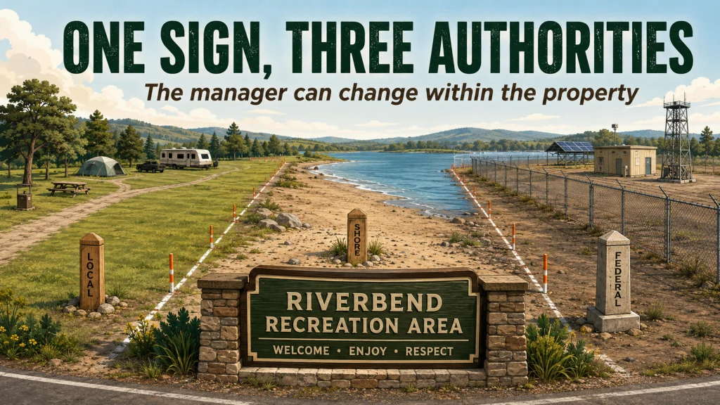
Similar names are especially risky around reservoirs and large recreation complexes. A county may operate a campground on federal project land, while a nearby day-use field belongs to a city and the shoreline is controlled by another office. Do not combine those areas into one answer just because they share a sign or parking entrance.
Field Note: In land records, the familiar name printed on a map and the entity responsible for the parcel are often different pieces of information. I check both before I spend time reading rules, because a perfectly researched rule for the wrong manager is still the wrong answer.

AquaQuest Trail Map Case is designed as a waterproof holder for maps, documents, and other small items. It has a clear viewing window and includes a lanyard for carrying in the field. The listing states that it protects contents from rain, snow, dirt, dust, sand, and brief temporary submersion.
Check On AmazonIf you click this link and buy, we earn a commission at no additional cost to you.
Use an Official Verification Order Instead of Stopping at One Webpage
Public land metal detecting rules are usually spread across several documents. A general recreation page may say nothing about detectors, while the controlling language sits in a municipal code, agency regulation, superintendent’s compendium, forest order, permit page, or temporary closure notice. Silence on the first page is not permission.
I use a fixed order so an old blog post, search-result snippet, or front-desk guess does not outrank the current rule. Start with the strongest controlling material, then work down toward unit guidance and written clarification.
- Current regulation, ordinance, or code: Find the legal rule that applies to the managing authority and activity.
- Agency policy: Check the agency’s recreation, cultural-resource, collecting, or surface-disturbance policy.
- Individual unit page: Review the page for the exact park, forest, field office, reservoir, or project.
- Permit page: Confirm whether a metal detecting permit, special-use approval, or written authorization exists.
- Manager order or compendium: Look for local orders that narrow or close areas beyond the general rule.
- Alerts and closures: Check the date for construction, fire, habitat, event, safety, and seasonal restrictions.
- Written confirmation: When the documents conflict or leave a real gap, ask the responsible office in writing.
After any phone call, ask where the answer appears in writing or request a follow-up email. A verbal “should be fine” is weak evidence when another employee, ranger, or officer encounters you in the field. The goal is not to collect paperwork for its own sake. The goal is to make the allowed activity and approved zone clear before the coil comes out of the vehicle.
START: Mark the exact ground you intend to search.
Manager known? If no, stop and confirm ownership, jurisdiction, and operating authority. If yes, continue.
Current rule found? If no, check the code, agency policy, unit page, permit page, and manager orders. If yes, continue.
Detector use allowed? If no, choose another location. If yes or conditional, continue.
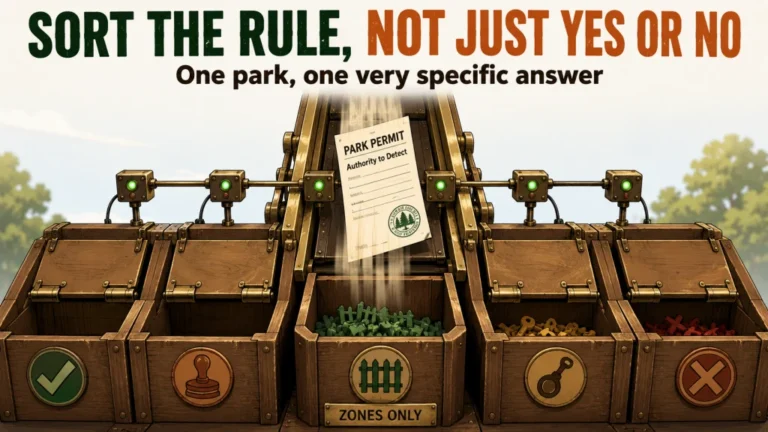
Probing, digging, and removal allowed? If any answer is unclear, request written confirmation before disturbing the surface.
Temporary closure or boundary conflict? If yes, resolve it or stay outside the affected zone. If no, continue.
RECORD: Save the rule date, official page, contact, permit, approved map, and reporting instructions.
This flowchart prevents the most common shortcut, finding one positive sentence and treating it as approval for the whole hunt. Every “yes” must apply to the same manager, same unit, same zone, same date, and same activity you plan to perform.

Rite in the Rain Pocket Notebook is a compact 3.5 by 5 inch notebook made for field notes. Its weatherproof paper is designed to remain usable around water and outdoor conditions. The soft-cover format keeps the notebook small enough to carry with other detecting and verification gear.
Check On AmazonIf you click this link and buy, we earn a commission at no additional cost to you.
Verify Detector Use, Surface Disturbance, and Removal Separately
Metal detecting permits and park rules often divide the activity into layers. A rule may allow possession of a detector but prohibit its operation. Another may allow operation on a beach or athletic field but ban probing, plugs, shovels, or disturbance of turf. Even when recovery is allowed, the authority may restrict what can be removed or require reporting certain objects.
Do not compress all of that into “detecting allowed.” Write a separate answer beside every action you intend to take. This is where many otherwise careful detectorists get into trouble, because the permission to swing a coil feels like permission to complete the recovery.
| Permission layer | Question to verify | Why the answer can differ |
|---|---|---|
| Possession | May I carry or transport a detector in this unit? | Some systems regulate possession, not only active use. |
| Operation | May I turn it on and search in this exact zone? | Approved areas may exclude historic, landscaped, or developed locations. |
| Probing | May I use a probe or screwdriver? | A low-impact tool can still count as surface disturbance. |
| Digging | May I cut a plug, scoop, scrape, or excavate? | Digging may need separate authorization even when detector use is allowed. |
| Tools | Which recovery tools and blade sizes are permitted? | Some managers limit shovels, picks, powered tools, or digging depth. |
| Removal | May I keep the object, and which objects must remain? | Lost property, cultural material, natural resources, and project property follow different rules. |
| Reporting | What must be reported, to whom, and before moving it? | Older, unusual, hazardous, or potentially archaeological finds may require immediate reporting. |
Warning: A detector signal does not establish ownership of the target. If an object may be archaeological, historic, hazardous, government property, or identifiable lost property, stop disturbing the area and contact the manager.
Also verify approved zones, operating hours, restoration requirements, permit display, and find-reporting procedures. When the written rule allows only surface finds, a target that requires scraping or soil removal is outside that permission even if the machine detected it legally.

CKG Metal Detecting Shovel is a heavy-duty digging tool made for metal detecting and root cutting. It has a double-serrated tempered-steel blade and a T-style handle. The Amazon listing gives the shovel a 5.5-inch blade length and an overall length of about 39.5 inches.
Check On AmazonIf you click this link and buy, we earn a commission at no additional cost to you.
Route the Search Through the Correct Land System
There is no reliable national ranking that says one class of public land is open and another is closed. City rules vary by municipality. State systems may combine statewide regulations with unit-specific approved areas. BLM and National Forest parcels can differ by field office, ranger district, land-use designation, cultural resources, mining interests, and active orders. Federal recreation projects may add another operating partner on top of the federal rule.
For city, county, regional, and state properties, continue with the process for checking city and county park rules. That route focuses on municipal codes, parks-department policy, state regulations, local permits, and individual park restrictions without assuming the rule transfers to the next jurisdiction.
For western public lands and forest parcels, use the separate framework for verifying BLM and National Forest rules. Those systems need special attention to field-office jurisdiction, forest orders, cultural sites, developed recreation areas, wilderness or conservation designations, mining claims, and the intended target.
National Park Service units, Bureau of Reclamation lands, USACE projects, ARPA questions, and other federal-resource limits belong in the guide to understanding federal land restrictions. Keeping these systems separate prevents a narrow allowance on one federal property from being repeated as a rule for all federal land.
Understand What ARPA Does and What It Does Not Do
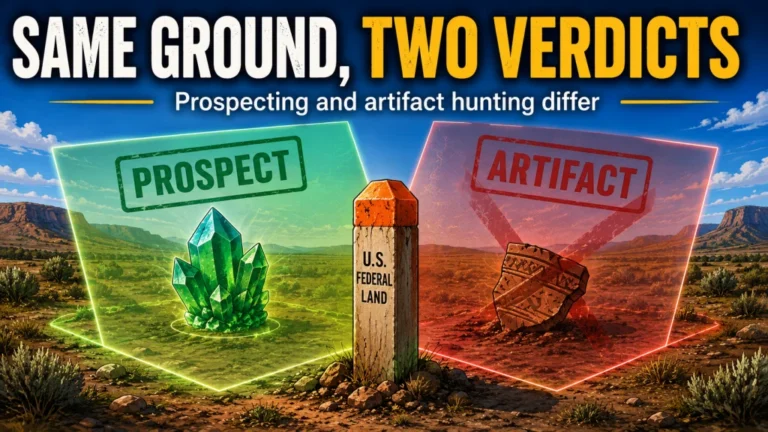
The Archaeological Resources Protection Act applies to archaeological resources on federal and tribal lands. In plain English, it addresses unauthorized excavation, removal, damage, alteration, and trafficking involving protected archaeological resources. It does not create a simple rule that every form of metal detecting is automatically prohibited on every acre of federal land.
Other rules still control the specific activity. National Park Service regulations restrict metal detector possession and use except for stated exceptions and authorized work. Reclamation and USACE properties apply their own regulations, permits, project policies, and ground-disturbance limits. BLM field offices and National Forest units may also publish activity-specific guidance or local orders, so an allowance from one unit cannot be carried to another.
Note: Confirm federal and tribal land rules against current official sources before the hunt. Rules, orders, closures, and permit procedures change, and this site cannot guarantee that a previously saved answer remains current.
Tribal and Indian land requires authorization from the appropriate tribal authority and compliance with applicable tribal and federal rules. Public access to a road, business, lake, event, or recreation facility does not grant permission to search surrounding land. Treat tribal sovereignty, land status, owner consent, and resource rules as controlling questions, not as a variation of a city-park permit.
Check Temporary Orders on the Day of the Hunt
A permanent rule can remain unchanged while the usable area closes temporarily. Events may reserve athletic fields. Construction may close a trailhead or expose protected material. Fire orders can restrict entry, tools, parking, or access routes. Habitat protection, maintenance, flooding, emergency response, and seasonal conditions can also override normal recreation access.
That is why the alerts page belongs near the end of the verification process, not the beginning. An alert tells you what changed today, but it does not replace the underlying code or policy. Check both. Save the closure date and map when the order covers only part of a unit.
- Special events and reserved facilities
- Construction zones and utility work
- Fire restrictions and emergency closures
- Wildlife nesting, habitat, or restoration areas
- Flooding, low-water exposure, erosion, and unsafe ground
- Seasonal maintenance and turf-protection closures
- Law-enforcement or public-safety incidents
A low reservoir or eroded bank may expose more ground, but exposure does not change ownership or make protected objects available for collection. In fact, unusual exposure can increase cultural-resource concerns and trigger stricter enforcement or emergency orders.
Resolve Inholdings, Easements, Claims, and Adjacent Parcels
Publicly managed landscapes are rarely clean blocks on the ground. A National Forest boundary can contain private inholdings. A public trail may cross an easement without opening the land beside it. A county park may sit next to school property. A federal reservoir may include leased facilities, state-managed zones, private shoreline parcels, and project land under different restrictions.
Check the exact parcel instead of relying on a broad color layer or a recreation-map boundary. Parcel records, official agency maps, posted signs, survey monuments, unit maps, and written manager confirmation should agree closely enough that you can identify where the approved zone begins and ends. When they do not agree, stay out of the uncertain strip until the responsible office resolves it.
Mining claims need separate attention. Public access across federal land does not mean every mineral or object is available for collection, and an active claim can create rights that affect prospecting or mineral recovery. Do not use a casual collecting rule as permission to interfere with a claim, equipment, workings, or materials belonging to another party.
Key point: A boundary check answers where you may stand. The activity rule answers what you may do there. You need both answers before detecting.

Garmin eTrex 32x is a handheld GPS navigator with a 2.2-inch sunlight-readable color display. It comes with TopoActive maps and supports GPS and GLONASS satellite systems. It also includes 8 GB of internal memory, a microSD card slot, a 3-axis compass, and a barometric altimeter.
Check On AmazonIf you click this link and buy, we earn a commission at no additional cost to you.
Build a Verification Record You Can Use in the Field
A complete record should be small enough to keep on your phone and specific enough to answer a manager’s questions. Save the date you checked the rule, the official page or document, the exact office, the name or title of the person who clarified the answer, the written response, permit conditions, approved map, and any reporting instructions.
Do not save only a screenshot of one sentence. Include the page title, manager, date, and surrounding conditions so the statement cannot be separated from its limits. A sentence allowing detector use in designated areas is incomplete without the current map showing those areas.
When Official Sources Conflict or Become Stale
If a regulation, unit page, permit page, and agency email conflict, do not select the most favorable answer. Ask the office controlling the parcel to identify the governing rule or order and confirm how it applies to detector use, disturbance, and removal. General guidance cannot override a regulation, closure, permit condition, or manager order.
Verify again when a permit expires, a closure appears, the approved map changes, a new season begins, or the saved rule lacks a current date. At sites affected by events, fire, habitat protection, construction, or water levels, repeat the alert check on hunt day.
Manager Contact Checklist
Ask all of the practical questions in one contact so the answer covers the complete recovery process rather than only detector operation:
- Which office manages the exact parcel and search zone?
- Are detector possession and operation allowed there?
- Are probing, digging, plugs, scooping, or scraping allowed?
- Which tools, depths, zones, hours, and restoration methods are permitted?
- Are a permit, approved map, display requirement, or advance notice required?
- Which objects may be removed, and which finds must be reported or left in place?
- Are temporary orders, events, closures, claims, easements, or adjacent parcels relevant?
Save the response with the contact name or title, date, permit, map, and linked rule so another employee can see how the activity was authorized.
Example: One Complete Manager and Rule Check
Consider a hypothetical Riverbend Recreation Area. The county name appears on the sign, but the official map shows a federal project with a county-operated campground. This process example is not a rule for any real park. Record the search zone, identify who can authorize disturbance, then check the regulation, operating rules, permit page, map, and alerts.
If the project page mentions permits but the campground rule is silent, ask the project office to confirm the approved zone and recovery conditions in writing. Save the permit, marked map, issue and expiration dates, office contact, and rule pages. Approval, a limited area, a surface-only condition, or a denial applies only to that parcel, manager, date, and activity.
Final Thoughts: Verify the Ground Before You Swing
Identify the manager, verify every part of the recovery process, and keep the current rule, permit, map, and written clarification together. I would rather spend ten more minutes confirming an approved zone than lose a hunt because the saved answer belonged to the wrong office or an expired condition.
Carry the verification record, repeat the closure check before arriving, and choose another location whenever the authority, boundary, digging permission, or removal rule remains uncertain.
Explore More Public-Land Detecting Guides
Once the manager is identified, use the guide that matches that authority. Each system has a different rule structure, so keeping the research path separate is more reliable than applying one park’s answer everywhere.
| Guide | What it helps with |
|---|---|
| City and County Park Rules | Checks municipal codes, parks policies, state systems, permits, approved zones, and local digging limits. |
| BLM and National Forest Rules | Separates field-office and ranger-district rules, cultural-resource restrictions, claims, orders, and land designations. |
| Federal Land Restrictions | Explains NPS, Reclamation, USACE, ARPA, permits, and federal resource-protection boundaries. |
Start with the manager you can document, not the land category that sounds most promising.
FAQs
🏞️ Can you metal detect in parks?
Some parks allow it, some prohibit it, and others limit it to approved zones, tools, times, or permits. Identify the manager and check the current code, policy, unit page, orders, and closures before operating the detector.
🗺️ Is public land automatically open to metal detecting?
No. Public access describes who may enter for allowed purposes, not permission for every activity. Detector use, digging, and object removal may each follow different rules.
📄 Do I need a metal detecting permit on public land?
That depends on the manager, unit, activity, and zone. A permit may be required, unavailable, or unnecessary for a narrowly defined activity, so confirm the current permit page and written conditions.
⛏️ Is permission to detect the same as permission to dig?
No. A manager may allow operation but prohibit probing, plugs, scooping, or any surface disturbance. Verify tool, depth, restoration, and removal rules separately.
🏛️ Does ARPA ban all metal detecting on federal land?
No. ARPA protects archaeological resources on federal and tribal lands and regulates unauthorized excavation, removal, damage, and related conduct. Other agency regulations, unit orders, permits, resource types, and planned disturbance determine whether a specific detecting activity is allowed.
🪶 Can I treat tribal land like other public land?
No. Obtain authorization from the appropriate tribal authority and follow applicable tribal and federal rules. Public access to a road, event, or business does not grant permission to search surrounding land.
📱 What proof should I save before a hunt?
Save the rule date, official document or page, manager’s office, written response, permit, approved-zone map, closure check, and reporting instructions. Keep enough context to show the conditions, not only one favorable sentence.
☎️ What should I do when the agency answer is unclear?
Ask the office with authority over the exact parcel for written clarification. If the manager, boundary, digging permission, or removal rule remains uncertain, do not detect there until it is resolved.
Sources and References
- Electronic Code of Federal Regulations, 36 CFR 2.1: National Park Service rules protecting natural, cultural, and archaeological resources, including restrictions on metal detector possession and use.
- Bureau of Land Management, Archaeology Program: BLM responsibilities, archaeological permits, and protection of cultural resources on BLM-managed lands.
- U.S. Forest Service, Daniel Boone National Forest Alerts: An official example showing how forest orders and local alerts can impose unit-specific metal detecting restrictions.
- Bureau of Reclamation, New Melones Recreation and Resources: Current project guidance referencing the Reclamation restriction on metal detector use and protection of exposed historic resources.
- Electronic Code of Federal Regulations, 36 CFR Part 327: Rules governing public use, ground disturbance, project property, permits, restrictions, and closures at USACE water-resource projects.
- U.S. Army Corps of Engineers Vicksburg District Permit Page: An official example of project and district offices requiring approved metal detecting permits for specified locations.
- Electronic Code of Federal Regulations, 43 CFR Part 7: Uniform regulations implementing the Archaeological Resources Protection Act on federal and Indian lands.
- Bureau of Indian Affairs, Trust Land Acquisition: Official explanation of tribal trust lands, tribal control, and the role of tribal consent and sovereignty.